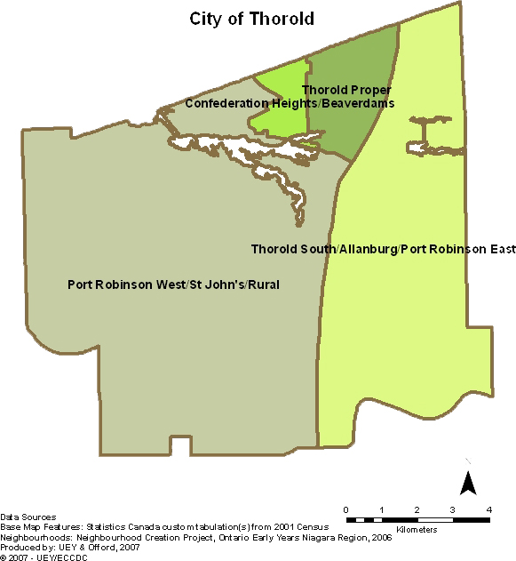
We have also worked closely with the Early Years Niagara Research Advisory Group and the Niagara Region's Ontario Early Years Data Analysis Coordinator to make decisions on how best to report the information given mandated restraints (i.e. neighbourhood samples with less than 30 children cannot be reported on in order to protect confidentiality and privacy).
As a result, 2 of the 4 neighbourhoods in Thorold were amalgamated in order to report on EDI data and create a long-term workable solution. Neighbourhoods were amalgamated based on geographic proximity and similar socioeconomic conditions. This map will only be used for reporting EDI results. Maps with the original neighbourhoods will be used to report on socioeconomic conditions and community resources and their names will be included in all maps - out of respect and appreciation for the work and wisdom of the community champions who participated in the Neighbourhood Creation Project. Click here to see the amalgamated neighbourhoods in Thorold.
"With a population of over 18,000 spread over approximately 8,490 hectares (21,000 acres) of agricultural, commercial, industrial and residential land the City of Thorold, has something for everyone. ...Thorold which is centrally located within the Niagara Region is also the centre of North America’s profit zone, within one day’s driving distance of 60% of the North American population. The City is conveniently located within a modern transportation hub and enjoys access to the Atlantic Ocean and the Great Lakes, via the St. Lawrence Seaway - Welland Canal, while convenient rail linkages provide access throughout the United States and Canada."
Copyright © 2007 City of ThoroldClick here for more information on the City of Thorold.


